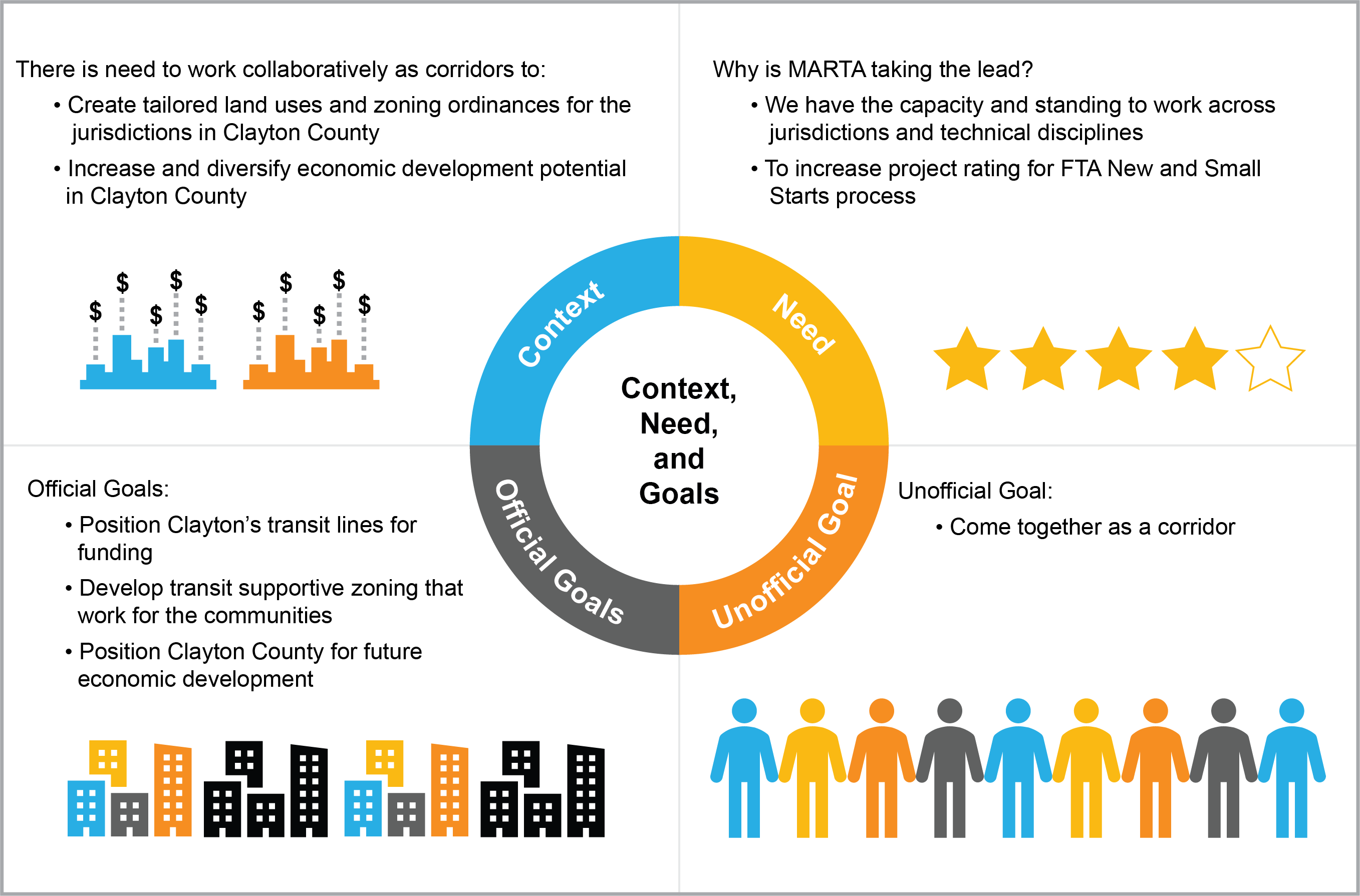
 Image description: The graphic above has four quadrants outlining Clayton County’s desires including tailored land uses and zoning ordinances (Context), the need for MARTA’s support (Need), the county’s goals for future economic development (Official Goals), and goal for corridor unity (Unofficial Goal).
Transit Supportive Land Use
Current Status
Study complete.
Project Overview
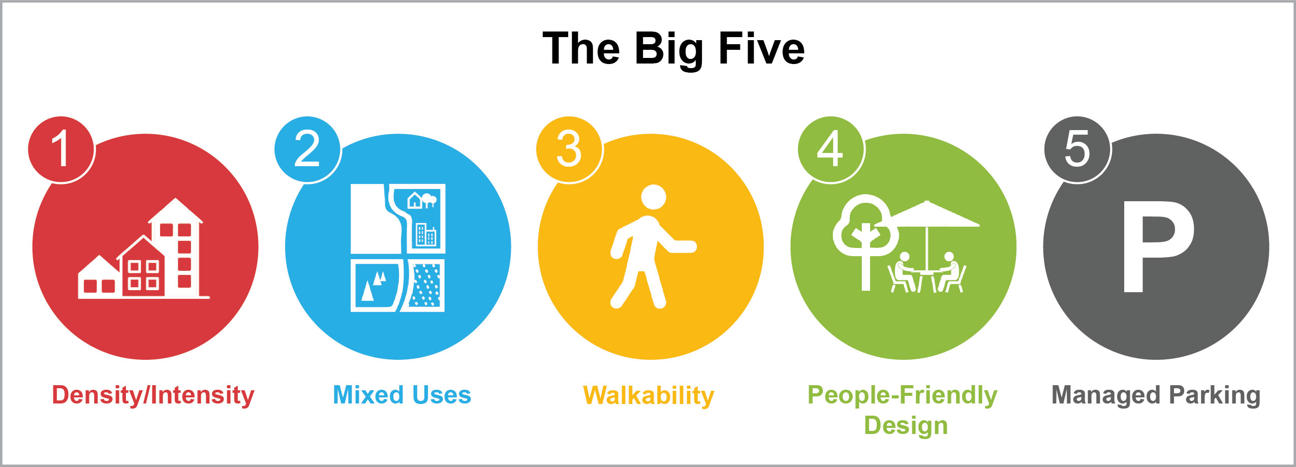
The transit Supportive land use study explores the potential for higher-density, multi-family residential, commercial, or mixed-use developments that are typically common in transit-oriented development (TOD) patterns. To assist Clayton County’s transit projects in the federal process, MARTA, Clayton County, and local jurisdictions need to work together to implement the Big Five:
- Density/Intensity
- Mixed Uses
- Walkability
- People-Friendly Design
- Managed Parking
Clayton’s future high-capacity corridors (SR 54 and SR 85) are not “transit- friendly” in terms of land use or zoning. Currently these communities have:
- Low density
- Single/homogenous uses
- Poor walkability
- Suburban-style site design oriented to car
- Over-abundance or surface parking
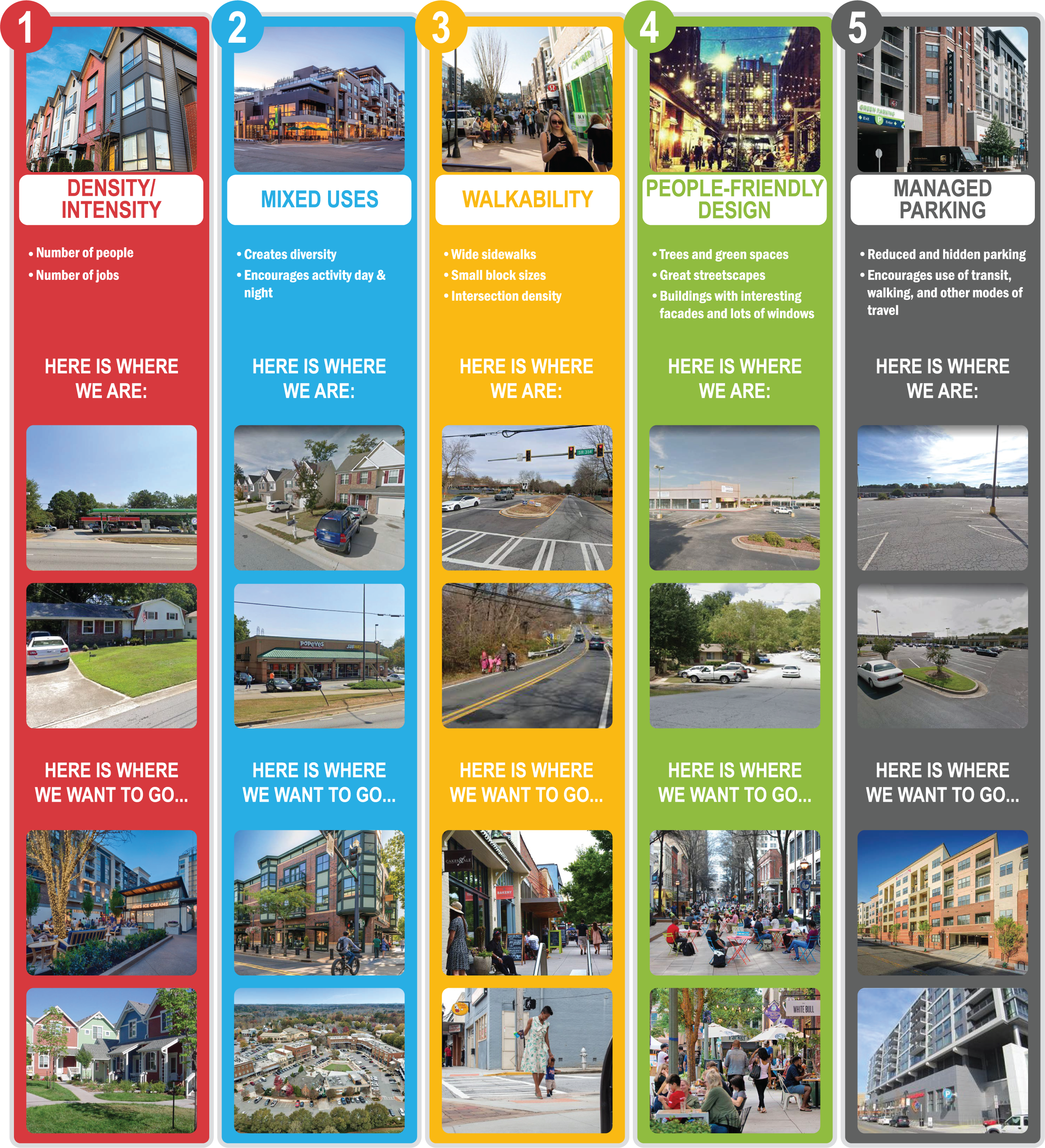
Image description: The graphic illustration above shows Clayton County's "Big Five" planning concepts by comparing side-by-side photo examples of current development patterns ("where we are") with desired future development patterns ("where we want to go"). “The Five” planning concepts are: Density/Intensity, Mixed Use, Walkability, People-Friendly Design, and Parking Management.
Resources/Documents
In 2022, the MARTA team coordinated with jurisdictions in South Fulton County and Clayton County to develop amendments to their comprehensive plans. These amendments included language to allow for zoning of land uses that support transit in their geographic areas. Recommendations to the amendments for each jurisdiction is listed below:
Southlake Transit-Oriented Development Study
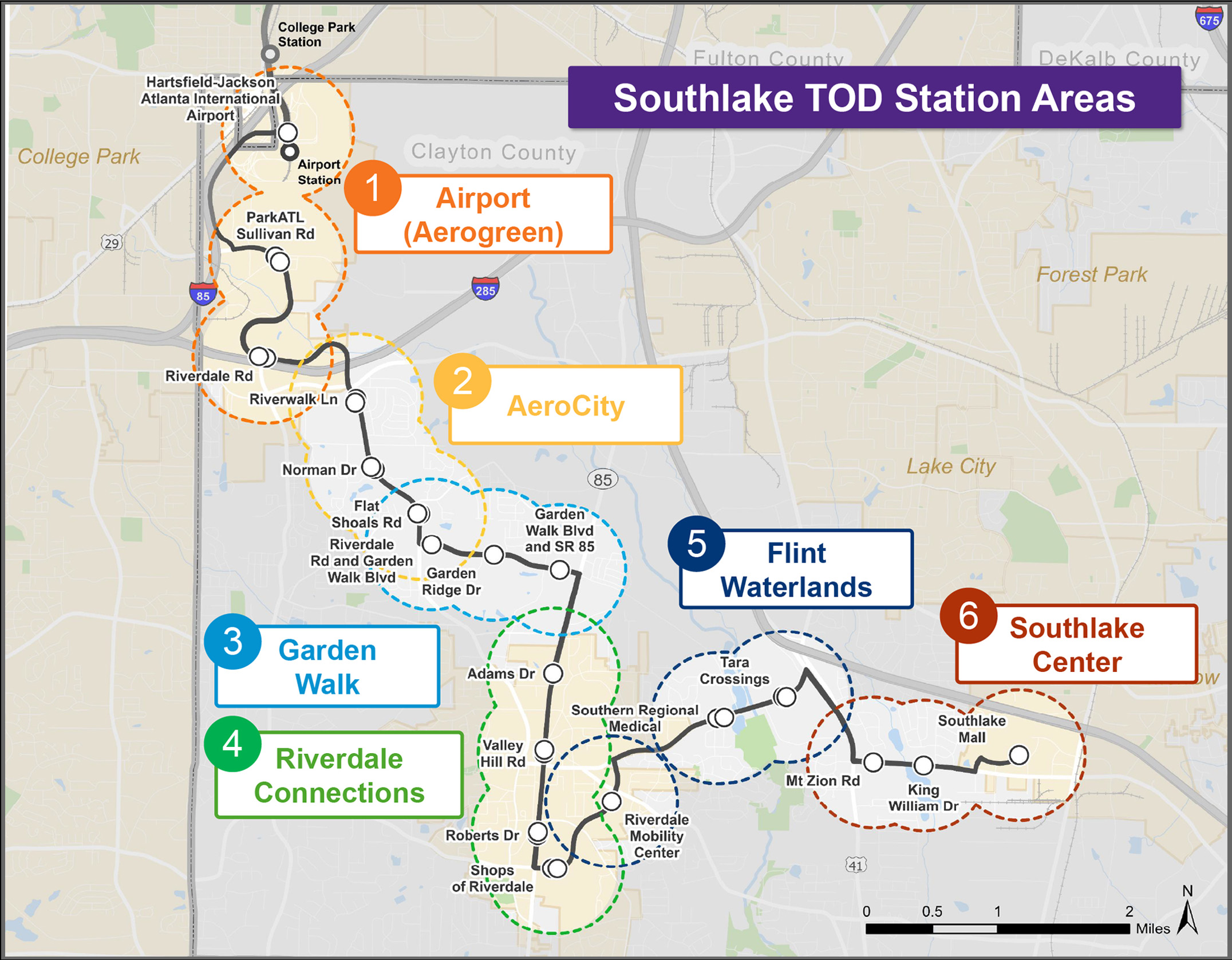 Image Description: The graphic illustration above shows a map of the Southlake TOD Station Areas along the future Southlake BRT corridor in Clayton County. The map highlights six distinct station areas, each outlined in a different color and labeled with a numbered marker: (1) Airport (Aerogreen), (2) AeroCity, (3) Garden Walk, (4) Riverdale Connections, (5) Flint Waterlands, and (6) Southlake Center.
Current Status
Study in progress.
Project Overview
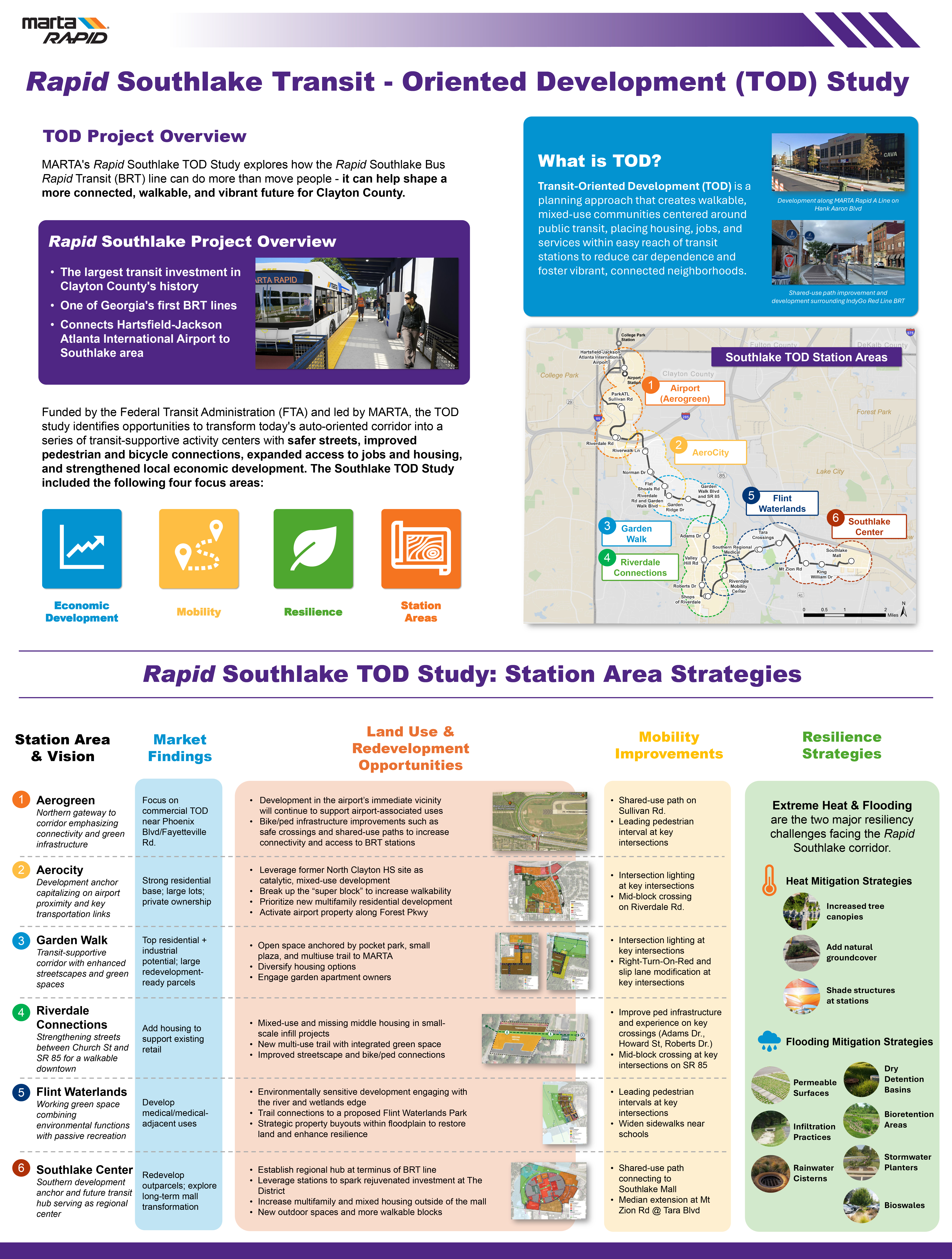
The Southlake TOD Study is an FTA-funded planning effort led by MARTA to help guide future growth and investment along the Rapid B-Line (Southlake BRT) corridor. The study explores how transit can support vibrant, connected, and resilient communities through:
- Station Area Planning
- Economic Development
- Mobility Improvements
- Corridor Resilience
The study includes recommendations for land use, economic development, open space design, and stormwater management while identifying opportunities to improve pedestrian and bicycle connectivity, multimodal safety, housing, jobs, and redevelopment along the corridor. It also considers strategies to address flooding and extreme heat.
For more information on Rapid B-Line (Southlake) TOD, see graphic below.
Resources/Documents
Southlake TOD Project Boards
Stay Informed
Please submit comments regarding the project to:
Sidney Douse III
Director of Policy Planning
sdouse@itsmarta.com